Ride the Rockies Blog as Peak Pedaler #RetireeBookie:
Rad Ride into Ridgway and Onto Pie
Montrose Pie Ladies, I love all the fruit pies you offer RtR riders. Falling asleep last night after a more hellish day than last year’s Copper Triangle – 20 miles and 2000 more feet of elevation – I dreamt you wouldn’t be at the fair today. This is my sixth Ride, third stop in Montrose, so I’ve come to expect my ala mode slices as a reward. I even rode that out and back Challenge, thinking I’d be jinxed otherwise. Thanks for the homemade pies.
Shiver me limbs, the start from Durango was cold through that canyon. Coal Bank Pass pushed me, to the point that I stopped twice up Molas ostensibly to take pictures. Red Mountain took my legs away. Was it psychological seeing the road above, how far I had to go? Stopped six times but didn’t sag. I had this rule years ago that if I stopped anywhere but Aid stations, I had failed. Not so anymore. I’m re-tired, I’ll take my sweet time after a few rounds of “shut up legs”. Then that decline through the castellated Ouray canyon – screaming!
The first Ride my son and I did in 1996, I carried a point and shoot camera, but only took one picture the first day. I found climbing that I didn’t want to break what little momentum I had to shoot a photograph of panoramas that pale in comparison to the real thing. Descending was too much fun to slow to film a blurred moment. With phones, the camera quality has gotten so superb, they’re worth carrying for that reason alone. But you still have to stop! I may do it to spell the gams, but the descent is worth recording – stop and suck up to the vistas – shoot a memory.
I can’t say the crew I’m camping with minds that advice. Bon Fils, Jonny Demon, Golden Boy, and Sweeney are banking those Strava records – that’s Dexter, Jon, Ken, and Bret for truth’s sake. They’re having a good time pushing each other on sprints for city and county signs. I tail them into camp, but we gather for lunch, drinks, and dinner. In Ridgway, I signed out before dinner after Eatery 66 and ice cream to the Sextones in the park. Tough ride, but today’s ala mode raspberry then blueberry rhubarb pie is all good.
Michael Thornton #RetireeBookie
Steeple Chase over Wolf Creek Pass
Hope all you Flatlanders and Midwest gals and guys enjoyed Sunday’s steeple chase over Wolf Creek Pass. We broke camp about 6 am and this #RetireeBookie was on the road by 7, a full 45 before the rest of my entourage. We typically choose playing field spots as far away from other campers as possible, not because we’re misanthropes, but to avoid the zipper hour of 4 am, when riders anxious to get on the road by 5 break camp, especially on a long day like today.
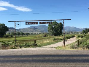
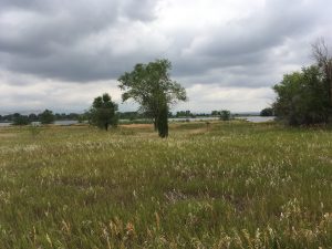
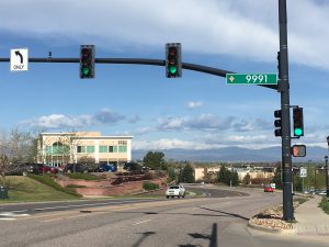
Three deer crossed the street in front of me in Alamosa – good sign or an omen? Felt great hopping on the bike Peace Trains on the flats, but after the first rest stop, with a too long line for flapjacks, the wind picked up and those pelotons became a necessity. I pulled on a few – I’m the OG or old goat in the snakeskin jersey – which I regretted as the wind kept up. I saw a dead deer on the side of the road, and that’s how I was beginning to feel. The panoramas were stunning, in these mountain valleys on the way to Del Norte and Monte Vista. Check out the Valle Vista sign and the mountain beyond….
The climb started to take its toll as I started depending on that small ring on the cassette I bought after last year’s Ride. A few miles up, the Son passes me with his friend the Designer calling me out but he recounts his surprise later that I was halfway up the pass before he caught me. He also lets me know that he had the fastest Strava time for the day, tenth overall. I don’t get to ride with him outside of his chillaxin’ rides. They rolled past the Aid Station but I took advantage of those potato diggers from the San Luis Valley – I was a little baked but that potato got me over the top, just like they said it would. I took a pic of those cool cats serving spuds, and wasn’t that a fun descent! Alamosa to Pagosa copacetic. Even the Barber from Brooklyn in our crew made it in fine shape, the longest ride in his career.
Michael Thornton #RetireeBookie
Training for Ride the Rockies as Peak Pedaler #RetireeBookie:
Lookout Mountain
For Denver riders, Lookout Mountain outside Golden provides some close-by climbing, with about 2500’ of elevation gain from downtown. I first climbed it over 50 years ago, when I was in my teens, with a couple of school chums and a fellow paperboy two years older, Crazy George, who proved his namesake that day as he schooled us climbing on our ten speeds before proceeding to pass cars as he rolled back down to Golden. Recalling this reminds me that my son at the age of 16 on his first Ride The Rockies didn’t hold back when organizers stopped the riders from descending into Telluride during snow flurries – the boy took off before the ride was halted, passing a Fat Tire Beer truck on the way down.
When I was a kid, Lookout Mountain was known for its radio towers, and later television towers, since Denver clearly connected via its airwaves to this mountain in the Front Range west of the city. There was also Sam’s on Lookout Mountain, where 18 year olds could drink 3.2 beer at the top, and then drive recklessly to the bottom. When the liquor laws changed, Sam’s shut down. Residents and parents were thankful. About 18 years ago, another teacher and I at PS 1, a charter school in Denver, made a climb on the dirt trails up Lookout the final for our class on bicycling. Most days we took the students out along Cherry Creek in the riverbed where an entire system of trails appeared after mountain biking took off – the urban equivalent of mountain trails. Lookout was a treat for those youngsters to behold after riding along the creek for so many months. The challenge earned their praises.
The hardest parts of the climb may be at the start through the residential neighborhood before the stone gates announcing this Denver Mountaon Park, and the upper hairpin curves through the Ponderosa Pine forest before Buffalo Bill’s grave, which is at the top of Lookout. The hairpin curves make for an ascent of about 5.4%. Coming from south of downtown Denver, I put on 48 miles, which is a nice test for the legs and breath before this year’s Ride. Unfortunately, it started raining at the top, so the braking descent slowed my return. The rain followed me most of the way home. Call it another training day, since I’ve seen weather like this on a century day years ago on Ride the Rockies coming down off the Colorado National Monument. C’est la vie, any day on the bike is a good day.
Bear Creek Trail Loop
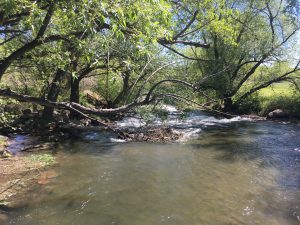
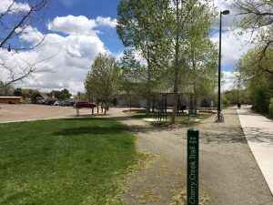
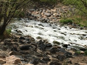
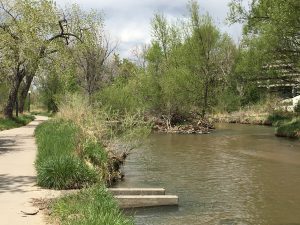
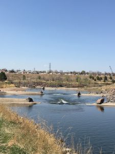
Rode the bike Friday, May 12, after days of rain and a hail-lacious storm on Monday. My training rides usually take advantage of the Denver area’s many trails – I live in the valley near both the South Platte River Trail and the Cherry Creek Trail. After a flood in 1965 washed through the valley, the U.S. Army Corps of Engineers built Chatfield Damn on the South Platte. Cherry Creek Damn held back a 16’ rise the night of rain before the flood in 1965. In cleaning up, trails were built along the rivers to accommodate maintenance vehicles. Denver started making improvements to the river in the 1970s, building a waterfront park at the confluence of the Platte and Cherry Creek. That park is currently being renovated. By 1984, Anne Whiston Spirn wrote in her Granite Garden that Denver had embarked on building trails along the rivers flowing through the city, which acted as natural conduits for wildlife and clean air. When cities across America started improving access to their rivers, treating them like amenities rather than industrial dumps, Denver had a jumpstart due to the flood.
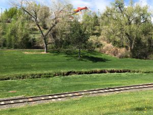
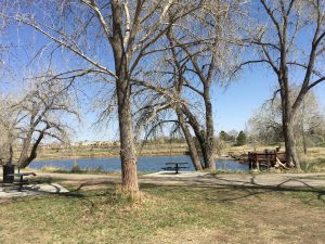
Today’s ride was about 37 miles – out and back along the South Platte and Bear Creek, with a loop around Fox Hollow Golf Club and Bear Creek Lake Regional Park. Here’s the link to a Google map that charts the route – it doesn’t include the mileage at the end of the loop back to the Alameda Light Rail stop: https://goo.gl/maps/F2q4LckVKoF2.
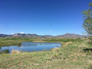
This ride follows the water flowing into the valley, with climbing to the top of Bear Creek Lake and around the park. The travel through Sheridan between Lakewood and Denver is Gran Prix worthy, with narrow asphalt paths, sharp turns, dark tunnels, and bridges over ditches – a fun spurt that demands good handling skills. I saw a woman who had dropped off the trail on a quick turn after a bridge – she wasn’t hurt, but be ware. Out and back with the loop is about 37 miles. Pedal it!
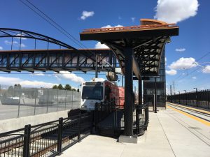
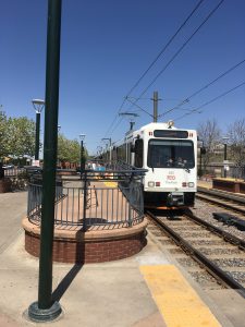
Posted routes with photos feature riding each of RTD’s Light Rail lines to its terminus and pedaling back to Baker, specifically the “White Whale” Light Rail stop at Alameda and Cherokee. Here’s the Light Rail Map: http://www.rtd-denver.com/LightRail_Map.shtml
Round trip from the “White Whale” station at Alameda to the unopened terminus of the G line at Ward Road in Wheat Ridge and back, about 36 miles total.
Here’s the Google Maps URL: https://goo.gl/maps/Y3GENjupiL52
From the Florida Avenue terminus of the H Line back to the “White Whale” station at Alameda
Here’s the Google Maps URL: https://goo.gl/maps/2JB5ZNQzaQS2
The End of the E and F Lines at Lincoln; bicycle back to Alameda station
Here’s the Google Maps URL: https://goo.gl/maps/RaCqYbG574D2
Bicycle out to Westminster Station B Line terminus, and Light Rail it back to Alameda Station
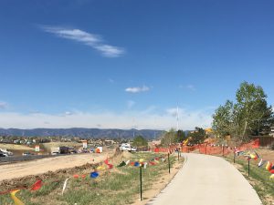
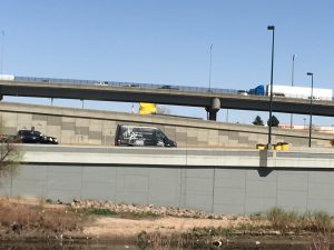
The route is simple enough: hop on the South Platte River Trail at Alameda, head north; detour around the construction in LoDo as well as RiNo, to the confluence with Clear Creek; head west on the Clear Creek Path past Pecos, and take the spur on the right around the new construction to 68th Avenue; head west as it bends to the north to become 70th; jog a block up Federal to 71st until you see the station at Grove. Here’s the Google Maps URL for the route: https://goo.gl/maps/nVaedbnP8uq Eventually a bicyclist will take the Little Dry Creek Trail near the Westminster Station, but it’s currently under construction.
C and D Lines from Mineral Avenue in Littleton along the South Platte River Trail
Here’s the Google Maps URL for the route: https://goo.gl/maps/xKdHxzYUzXr
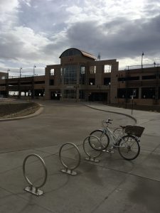
This is the end of the C and D lines, from Union Station and Five Points. It’s an easy bike ride out if you want to pedal both ways.
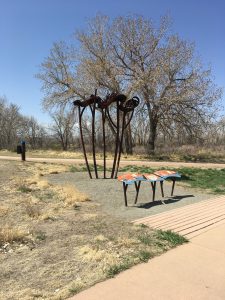
South Platte Park introduces the open space that abuts the trail through this first leg of the trip. Public Art perks up along the way.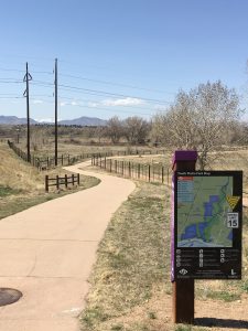
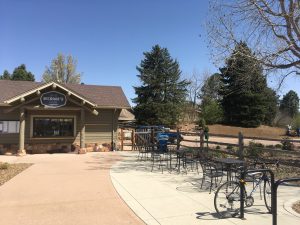
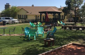
This is the most appointed path in Denver regarding restaurants right on the route. Pictured is Nixon’s at the back entrance to Hudson Gardens – refer to it fondly at “Tricky Dick’s.” The Platte River Yacht Club sits just east off the trail north of Hudson Gardens, followed quickly by Lucile’s Creole Cafe, sporting colorful plastic Adirondacks outside with a bocce court.
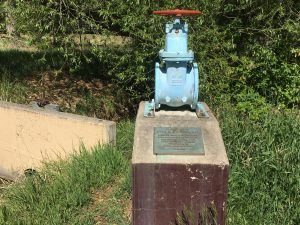
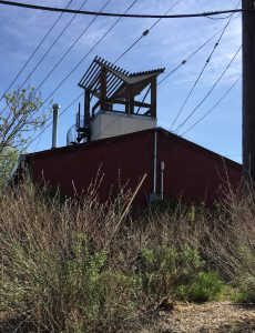
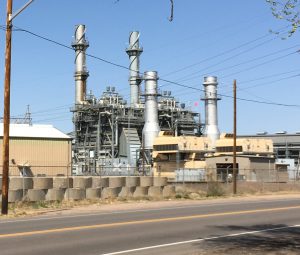
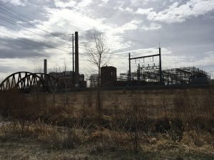
When I was working on the railroad, for the Colorado and Southern, all the live long day back in the 1970s, I was once escorted inside this public service station, to get water and relieve myself. It’s probably the closest Denver gets to having a reactor within its borders.
W Line and Lakewood Gulch Ride, Denver D10 route
Here’s the Google Maps URL for the route: https://goo.gl/maps/VxukNeoPnTG2
Light Rail station at the Jefferson County Government Center. The west terminus of the W Line – why didn’t Golden lobby for a stop in the city? It’s a shame the city missed out on this amenity beyond the transit opportunity – the bike path is a fine addition to Denver’s regional trails, especially as it parallels the West Line from Oak into downtown.
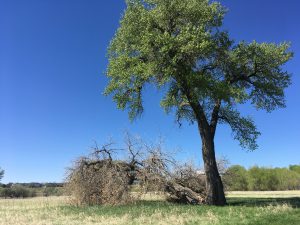
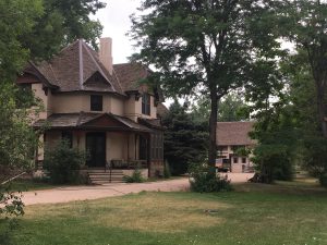
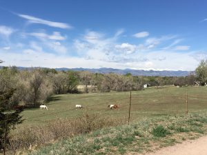
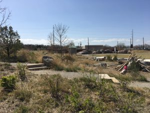
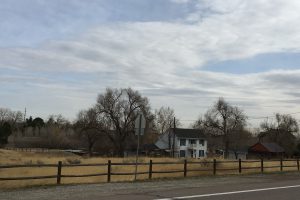
Leaving the station, the rider can see Golden Cemetery at the crest of the hill along Johnson Road. Pass Ulysses Park, the start of your odyssey, along West 10th before noting a lone farm stead pictured here.
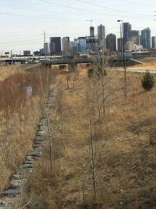
Riding next to Stevinson Toyota West and Colorado Mills only offers the rider a respite at the top of the hill along West 8th – a panorama of Table Mountain plus the eastern prospect of Denver’s downtown skyline, but most of the valley comprises a paved paradise.
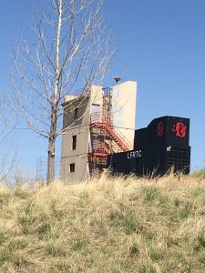
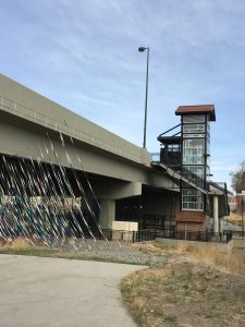
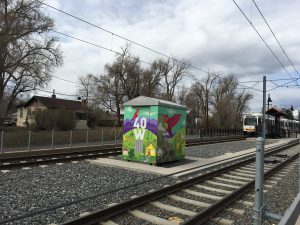 Public art in Colorado is paid through a percentage of the budget for public buildings. Along the W Line, mechanical sheds like this have been muralized. The “40W” painting refers to the 40 West Arts District whose artists wrapped many of the sheds as well as other walls near West Colfax in Lakewood.
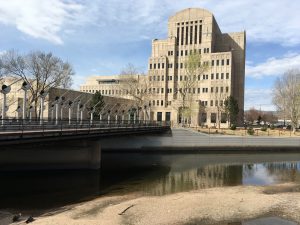
Denver Wastewater is housed in an architectural facade that looks like it’s straight out of Gotham City.
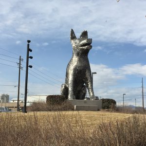
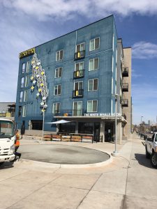
Finish the ride passing the brilliant dog sculpture made of identification tags at the Denver Animal Shelter before arriving at the Alameda Station, next to Denizen and the White Whale Room.